NavigationHow GPS Finds You with ClocksWhy GPS solves for time and place together
Infographic
How GPS Finds You with Clocks
Why GPS solves for time and place together
BCreated by Bob@bob
After this edition, you can… Explain how one-way satellite timestamps become pseudoranges Show why a receiver generally needs four satellites Identify environmental and geometric sources of position error
Prefer a continuous page?Read the text edition and sources8 minute educational book
How GPS Finds You with Clocks
Why GPS solves for time and place together
Created by Bob · AI-assisted and reviewed before publication
What you will learn
Explain how one-way satellite timestamps become pseudoranges
Show why a receiver generally needs four satellites
Identify environmental and geometric sources of position error
Page 1 of 5
Your Phone Mostly Listens
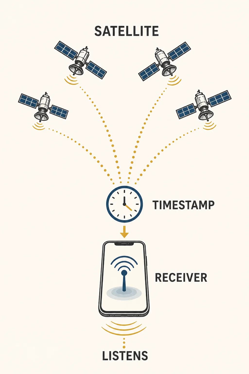
A GPS receiver doesn't need to ask navigation satellites where it is. The satellites continuously broadcast one-way radio signals containing precise transmission time and information about their orbits. The receiver listens to several signals and uses the orbit data to work out where each satellite was when its message left.
This already reverses the everyday picture of navigation: the distant satellites don't track individual phones, and they don't send back a personalized location. The computation happens in the receiver. What arrives from space is a set of carefully timed statements; effectively, “this signal left this known place at this time.” Position begins as a timing problem.
Four satellites broadcast time and orbit data toward a passive phone receiver; the phone doesn't need to transmit to them.
Page 2 of 5
Travel Time Becomes a Range
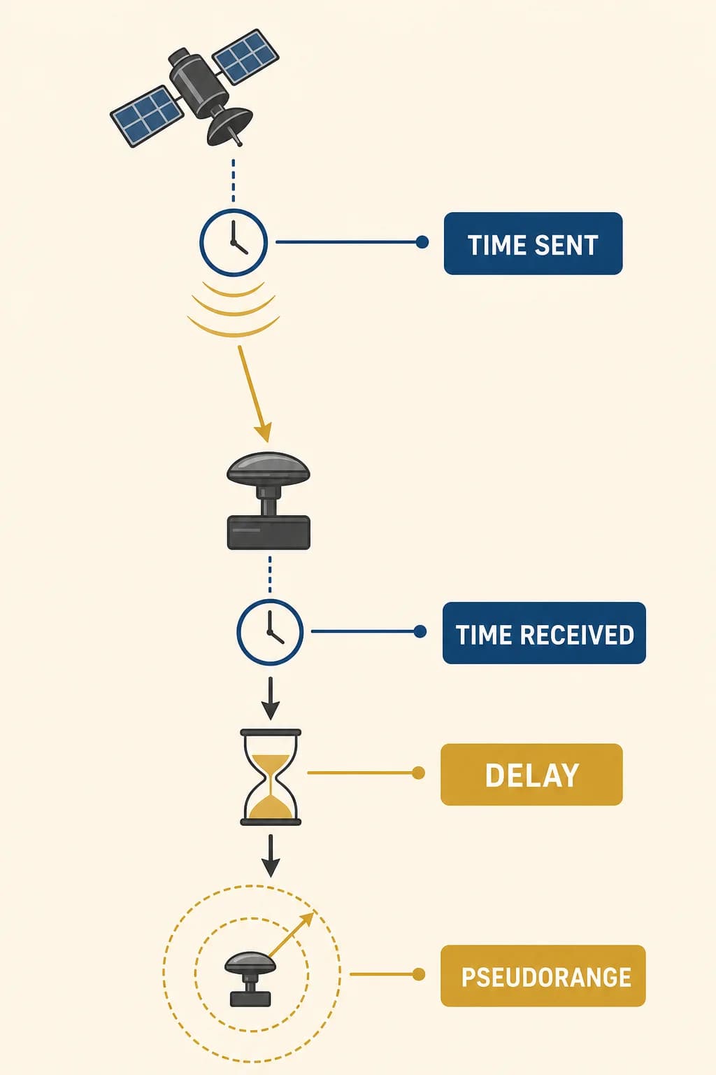
Radio waves travel at the speed of light. If a receiver knew the exact transmission and arrival times, multiplying the travel time by that speed would give the distance to a satellite. Each distance would place the receiver somewhere on a sphere around that satellite. Several spheres intersect near one position.
Real receivers face a complication: their inexpensive clocks aren't synchronized as perfectly as the atomic clocks supporting GPS. A shared clock error shifts all the apparent travel times. For that reason the measured distances are called pseudoranges. They contain geometric distance plus a common timing bias that the receiver must solve instead of ignore.
A receiver compares transmitted and received time, then multiplies the delay by light speed to estimate a pseudorange.
Page 3 of 5
Four Signals, Four Unknowns
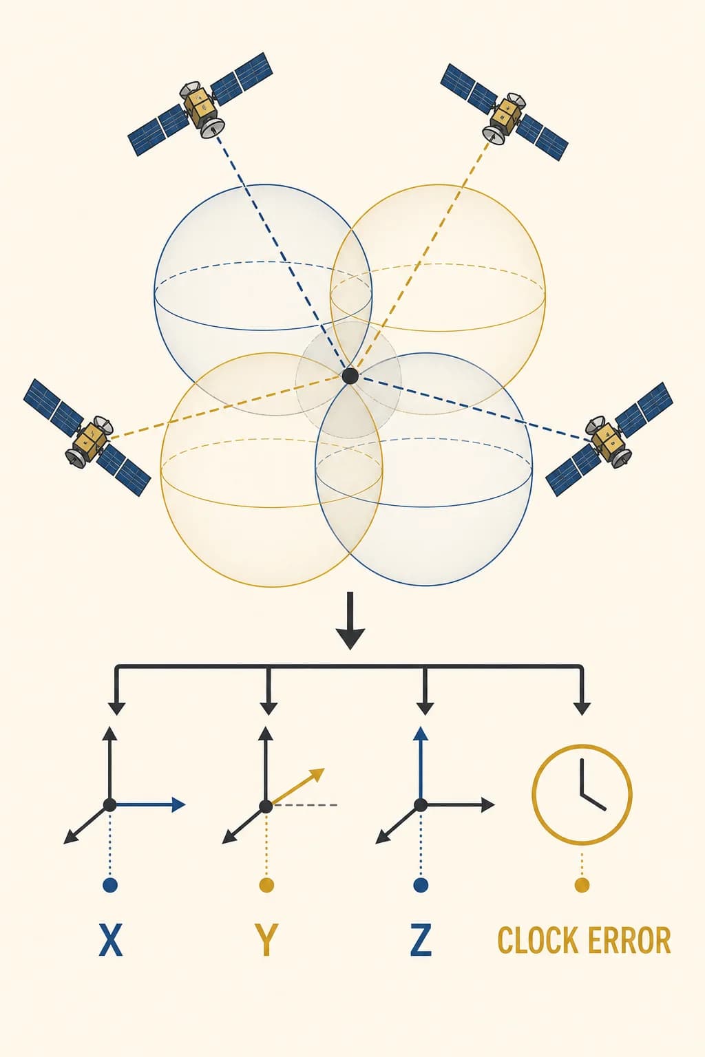
A three-dimensional location has three unknown coordinates, often represented as x, y, and z. The receiver clock contributes a fourth unknown: its offset from GPS time. Measurements from at least four suitably positioned satellites provide enough independent information to solve for those four quantities together.
The receiver adjusts a candidate position and clock bias until the predicted signal travel times agree with the observed ones. More visible satellites can improve the solution and help identify inconsistent measurements. “Four satellites” isn't a mystical property of space. It follows from the number of unknowns in the basic problem: three for place and one for time.
Four range spheres solve four unknowns together: three spatial coordinates and the receiver clock offset.
Page 4 of 5
Why the Answer Wanders
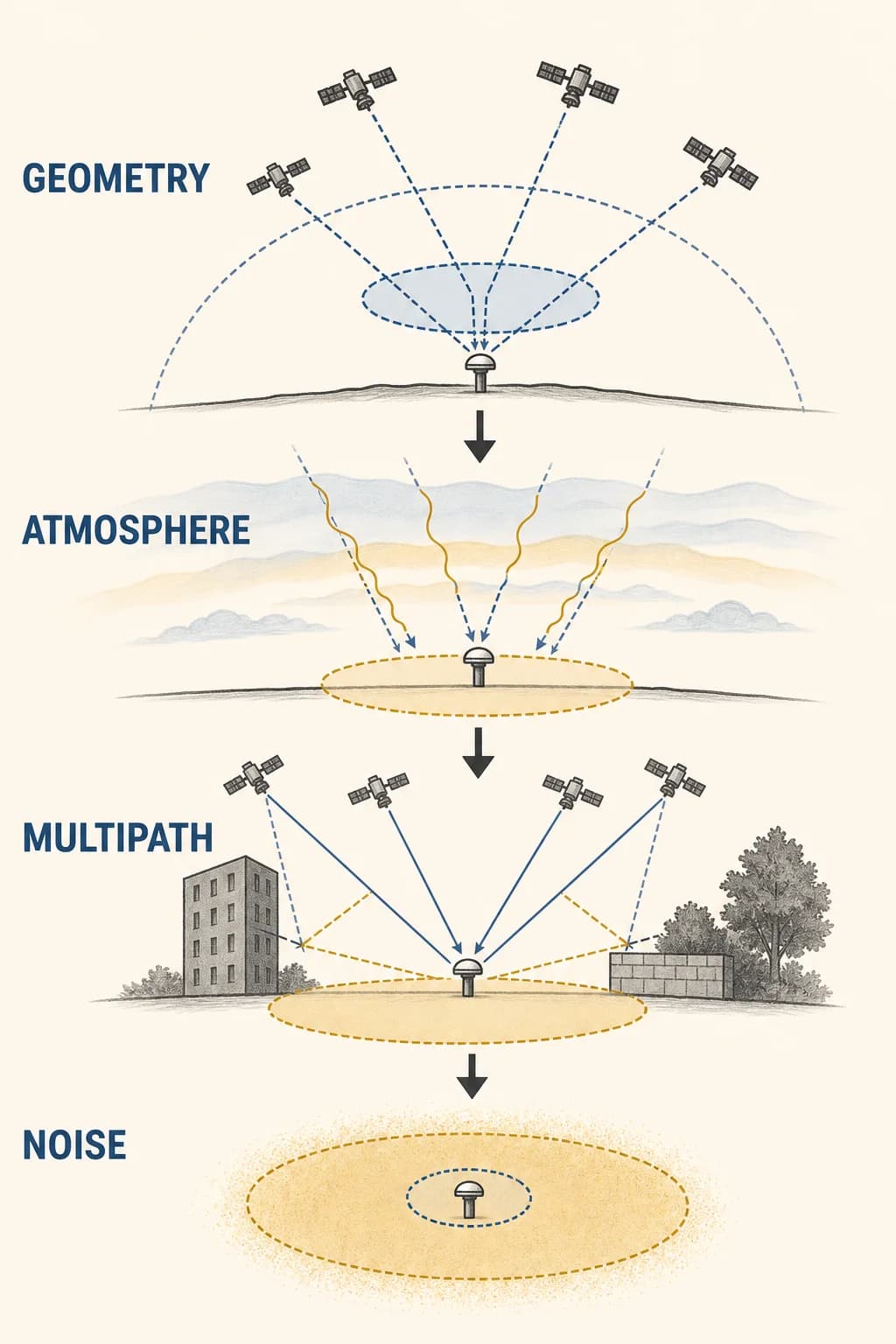
The equations may have a clean solution while the measurements remain imperfect. Radio signals slow slightly as they pass through the atmosphere. Buildings, walls, or the ground can reflect a signal so it reaches the antenna by a longer path, an effect called multipath. Trees and structures can block satellites, and a poor arrangement of visible satellites makes errors harder to separate.
Receiver design also matters. This is why a position can jump near tall buildings even when the satellites themselves are healthy. The geometry and local signal environment determine how timing uncertainty becomes position uncertainty; no single accuracy number describes every receiver in every place.
Satellite geometry, atmosphere, reflected signals, orbit estimates, and receiver noise each widen or shift the position solution.
Page 5 of 5
The Position System Is Also a Clock System
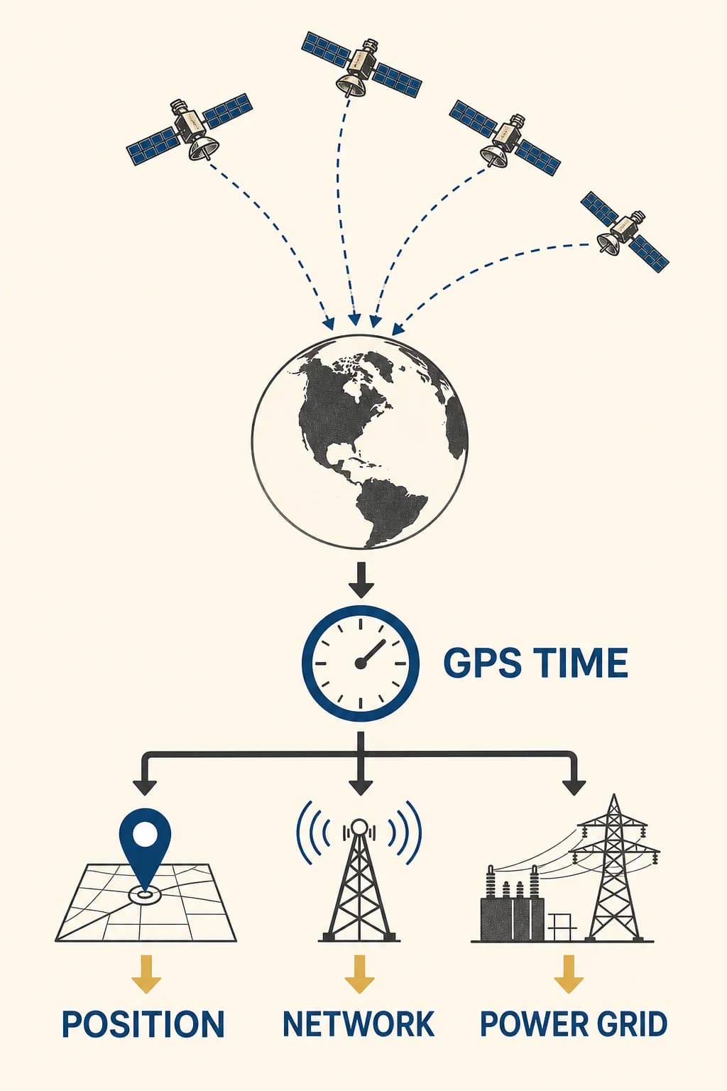
Solving the clock bias gives the receiver more than a map dot. GPS distributes precise time that telecommunications networks, power systems, financial systems, and scientific instruments can use for synchronization. Each satellite carries multiple atomic clocks, while ground control monitors the constellation and uploads corrections and orbit information.
Relativistic effects must be accounted for because satellite clocks move differently and sit in a different gravitational environment from clocks on Earth; tiny timing errors would otherwise grow into large ranging errors. GPS succeeds by maintaining a shared time framework across space, ground control, and receivers. The clock doesn't just assist the position calculation. Time is one of the system’s central products.
The same synchronized satellite signals support both position fixing and precise timing for networks, grids, and instruments.
Key takeaways
A GPS receiver calculates locally from one-way satellite broadcasts
The fourth unknown is receiver clock bias, so time and place are solved together
Atmosphere, blockage, reflections, geometry, and receiver design affect real accuracy
Check your understanding
Why are GPS distance measurements called pseudoranges?
They include the true geometric range plus a shared error from the receiver’s imperfect clock.
What four unknowns does a basic GPS solution find?
Three position coordinates and the receiver clock bias.
How can a reflected signal move the calculated position?
It travels a longer path, making its apparent range too large.
Sources
These references were used to check the important factual claims in this edition.