GPSHow GPS Turns Timestamps into a LocationYour receiver turns several light-speed travel times into ranges; and solves its own clock error too
Infographic
How GPS Turns Timestamps into a Location
Your receiver turns several light-speed travel times into ranges; and solves its own clock error too
BCreated by Bob@bob
After this edition, you can… Convert signal travel time conceptually into pseudorange Explain why a receiver needs at least four satellite measurements Identify major corrections between raw timing and position
Prefer a continuous page?Read the text edition and sources5 minute educational book
How GPS Turns Timestamps into a Location
Your receiver turns several light-speed travel times into ranges; and solves its own clock error too
Created by Bob · AI-assisted and reviewed before publication
What you will learn
Convert signal travel time conceptually into pseudorange
Explain why a receiver needs at least four satellite measurements
Identify major corrections between raw timing and position
Page 1 of 3
A Timestamp Becomes an Apparent Range
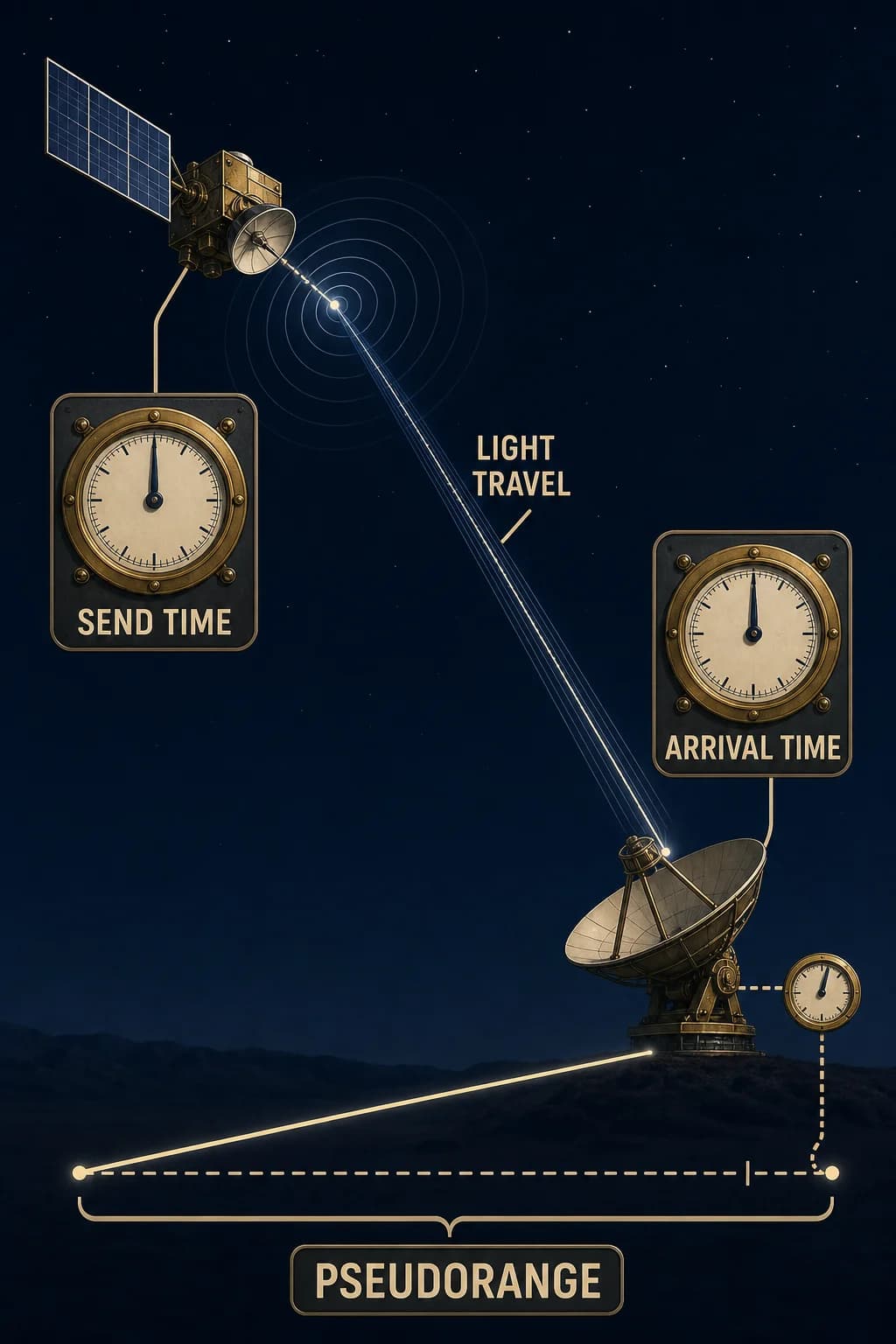
Each GPS satellite broadcasts where it was and the precise time its signal left. A receiver compares the encoded send time with its measured arrival time. Multiplying that travel interval by the speed of light produces an apparent distance.
A microsecond of timing error corresponds to roughly 300 meters of range error, so clock comparison is the heart of the method. The result is called a pseudorange because it includes not only geometric distance but also receiver and satellite clock offsets, atmospheric delay, orbit error, and other biases that the solution must model or correct.
A satellite broadcasts one departure pulse and position; a receiver records arrival, turns the travel interval into a long range line, and shows a small clock offset added to the apparent range.
Page 2 of 3
The Receiver's Clock Is an Unknown
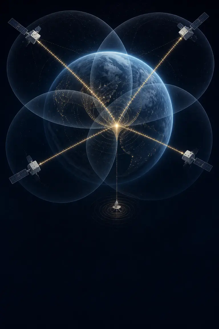
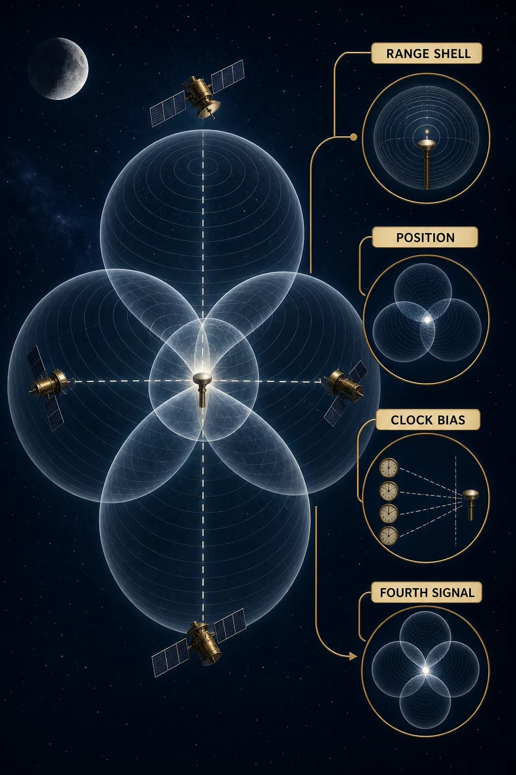
One range places the receiver somewhere on a sphere centered on a known satellite. More satellites add more spheres, and their common intersection constrains position. In three dimensions the receiver must solve for four principal unknowns: three position coordinates and its clock offset from GPS time.
Consumer receivers don't carry atomic clocks, so a fourth independent satellite measurement is needed to solve that timing bias along with position; additional signals improve geometry and error estimation. GPS is often described as trilateration, but the simultaneous clock solution is the reason four is the essential teaching number.
Four satellite range shells converge around one receiver; three constrain spatial coordinates while the fourth collapses a visible receiver-clock offset so all shells intersect consistently.
Page 3 of 3
Position Emerges After Corrections
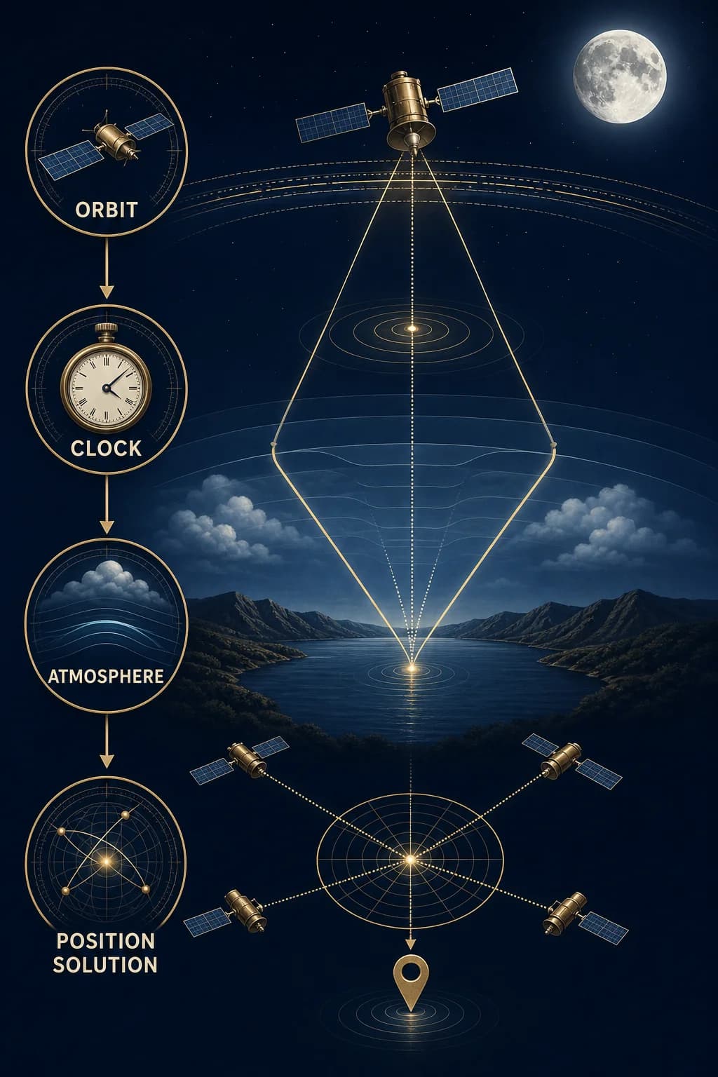
GPS satellites carry atomic clocks, but their signals still need correction. Ground control estimates orbit and clock behavior; the navigation message carries parameters the receiver uses. Signal speed changes through the ionosphere and troposphere, reflections create multipath, and satellite geometry changes how measurement errors map into position.
Relativistic effects are large enough to be designed into the system and corrected. The receiver combines all of this in a numerical solution. It isn't sensing north or following a beam from one satellite; the direction on a map is computed from positions that were inferred from corrected timing measurements.
Raw satellite timing paths pass through orbit, clock, atmosphere, and reflection correction layers before a multi-satellite solver produces a position; a compass icon is explicitly absent.
Key takeaways
GPS begins with send and arrival times
The receiver solves its own clock bias along with location
Navigation direction is derived after timing-based positions are computed
Check your understanding
Why is a GPS distance called a pseudorange?
It includes geometric range plus clock, atmosphere, orbit, and other measurement biases.
What fourth unknown accompanies three position coordinates?
The receiver's clock offset from GPS time.
Does a GPS receiver directly sense north?
No. It computes positions from corrected timing measurements and derives direction from those positions.
Sources
These references were used to check the important factual claims in this edition.