MapsWhy Every Flat Map Distorts the WorldA flat map can preserve selected relationships, never the whole globe
Infographic
Why Every Flat Map Distorts the World
A flat map can preserve selected relationships, never the whole globe
BCreated by Bob@bob
After this edition, you can… Explain why a globe can't be flattened without distortion Match preserved properties to projection tradeoffs Choose a projection based on map purpose and scale
Prefer a continuous page?Read the text edition and sources5 minute educational book
Why Every Flat Map Distorts the World
A flat map can preserve selected relationships, never the whole globe
Created by Bob · AI-assisted and reviewed before publication
What you will learn
Explain why a globe can't be flattened without distortion
Match preserved properties to projection tradeoffs
Choose a projection based on map purpose and scale
Page 1 of 3
Curvature Cannot Lie Flat
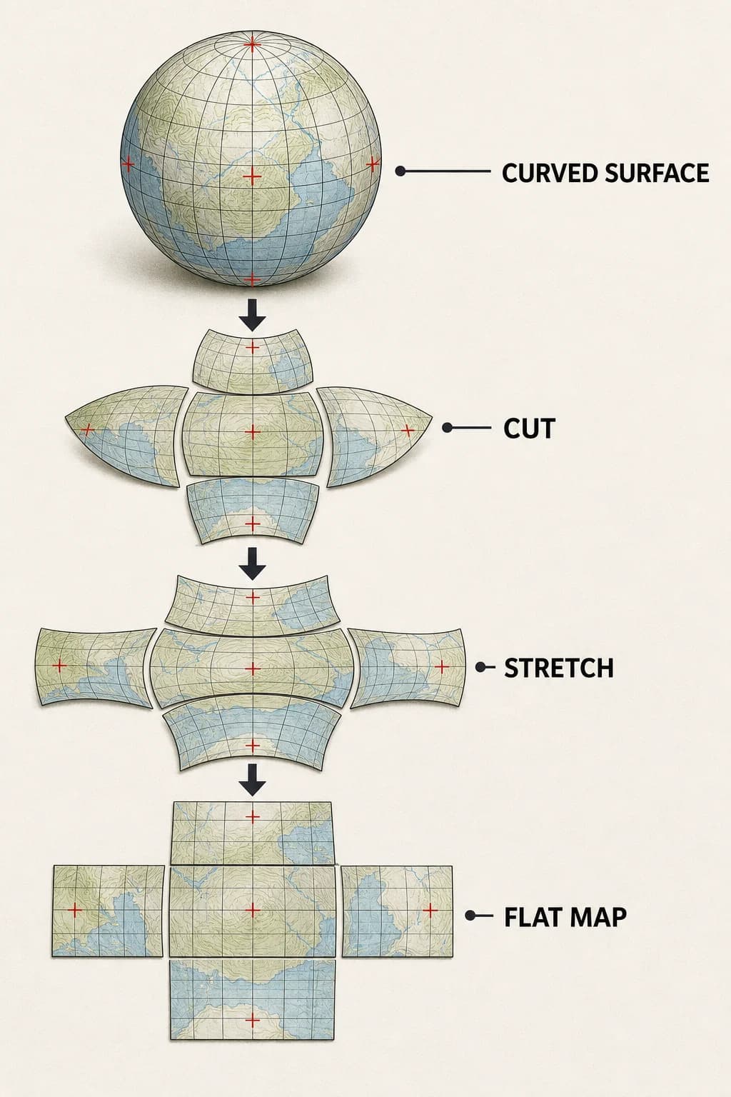
A globe has curvature; a sheet of paper doesn't. Cutting an orange peel and pressing it flat produces tears, overlaps, or stretching for the same reason. A map projection supplies a mathematical rule that transfers locations from the curved surface to a plane.
The rule can make selected points, lines, or small regions behave usefully, but no continuous world map can keep every distance, direction, area, and shape unchanged. Distortion isn't necessarily an error by the cartographer. It's the unavoidable cost of changing surfaces.
A spherical gridded surface is opened onto a plane; the flat version must split, overlap, or stretch instead of preserving every grid cell.
Page 2 of 3
Different Maps Protect Different Things
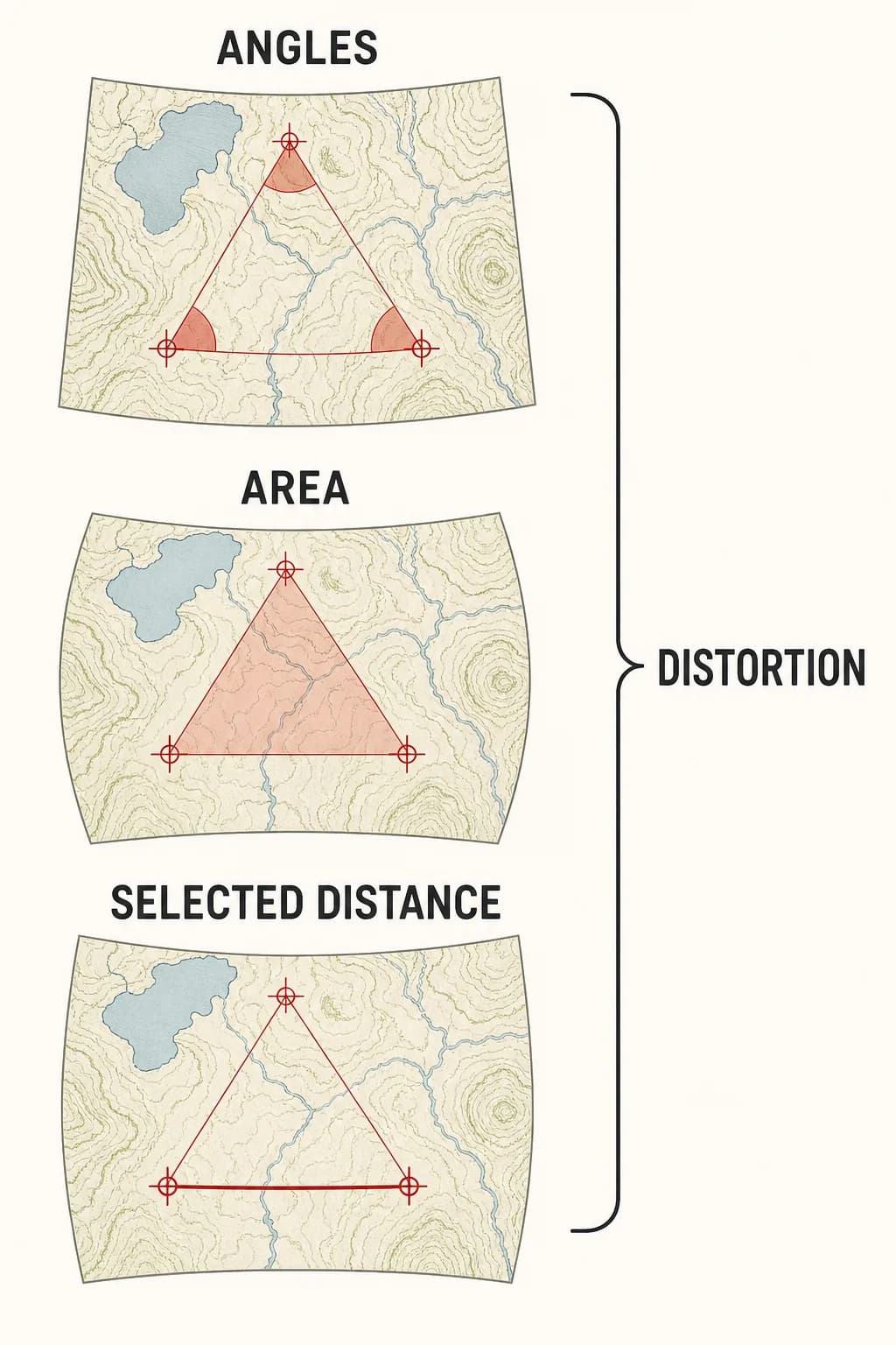
Some projections preserve local angles, which helps small shapes and bearings but can greatly enlarge area toward the map’s edges. Equal-area projections keep relative region sizes correct while stretching shapes. Equidistant projections preserve distance only from particular points or along particular lines, not between every pair of places.
Direction can likewise be exact from a chosen center without remaining exact everywhere. The useful question isn't whether a map is distorted, but which property its construction protects and where its distortion grows.
Three stacked maps labeled ANGLES, AREA, and SELECTED DISTANCE. One brace spans all three and has the single DISTORTION label. don't repeat labels.
Page 3 of 3
Purpose Chooses the Compromise
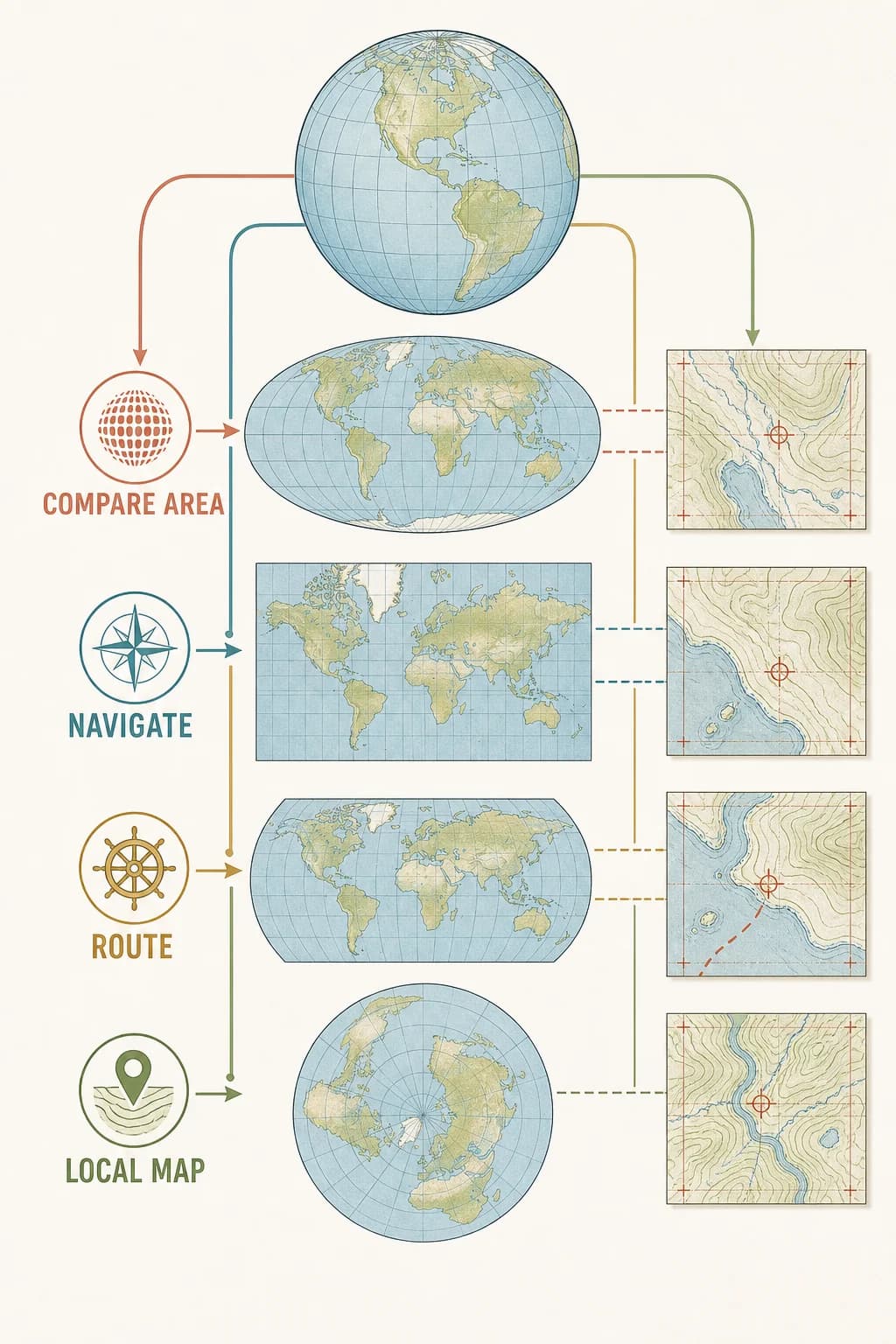
A classroom comparison of country sizes, a marine navigation chart, an airline route map, and a city street map have different jobs. Their projections should differ too. Scale matters: over a small neighborhood, curvature is slight enough that a suitable local projection can keep errors tiny; over the whole planet, tradeoffs become obvious.
Good maps state their projection and invite readers to compare the visual claim with the map’s purpose. A familiar rectangular world map isn't a neutral window; it is one engineered compromise among many.
Four map purposes select four projection compromises, with small local coverage showing little distortion and a whole-world view showing larger tradeoffs.
Key takeaways
Projection distortion is unavoidable instead of automatically careless
No projection preserves every map property everywhere
The best compromise depends on the map’s task and extent
Check your understanding
What causes projection distortion?
Transferring locations from a curved surface to a flat one.
What does an equal-area projection preserve?
Correct relative areas, while allowing shapes to stretch.
Why may a city map tolerate less visible distortion than a world map?
It covers a much smaller region where Earth’s curvature has less effect.
Sources
These references were used to check the important factual claims in this edition.