BordersWhat Turns a Line into a Real BorderA legal boundary becomes real through gates, records, infrastructure, and routines
Infographic
What Turns a Line into a Real Border
A legal boundary becomes real through gates, records, infrastructure, and routines
BCreated by Bob@bob
After this edition, you can… Distinguish a legal boundary from its surveyed realization Explain why ports of entry form a network of controlled passages Map how border institutions affect different cross-border flows
Prefer a continuous page?Read the text edition and sources5 minute educational book
What Turns a Line into a Real Border
A legal boundary becomes real through gates, records, infrastructure, and routines
Created by Bob · AI-assisted and reviewed before publication
What you will learn
Distinguish a legal boundary from its surveyed realization
Explain why ports of entry form a network of controlled passages
Map how border institutions affect different cross-border flows
Page 1 of 3
The Legal Line Needs a Physical Reference
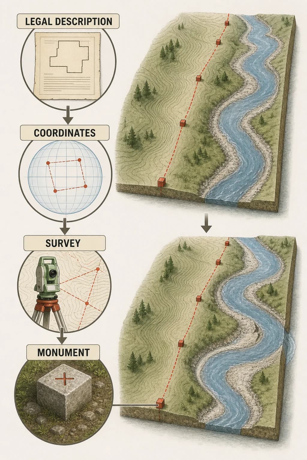
A treaty or law may describe a boundary with coordinates, rivers, ridgelines, or surveyed segments. Turning that description into a shared location requires geodetic reference systems, maps, monuments, and periodic maintenance.
Rivers migrate, markers decay, and old measurements may not align perfectly with modern coordinates. Boundary commissions can survey and clarify the line without changing the underlying legal agreement. The line on a small map condenses a much larger technical system for agreeing where that line lies on changing ground.
A treaty description passes through coordinates and survey work into physical monuments along a terrain boundary, while a migrating river shows why maintenance is needed.
Page 2 of 3
Crossing Happens at Organized Gates
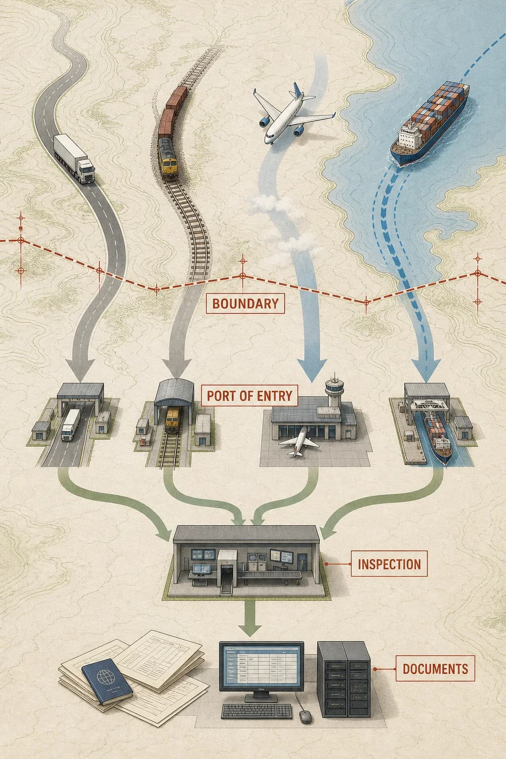
Most people and goods don't encounter every meter of a boundary equally. Roads, bridges, railways, airports, and ports concentrate legal crossing at ports of entry. Officers and carriers check identity, permission, cargo declarations, health rules, and duties through linked records and inspections.
Away from those gates, terrain, fences, patrol routes, sensors, and bilateral agreements shape enforcement differently. A boundary’s practical effect is a network of selective passages and controls, not a uniform wall with identical intensity along its length.
A long boundary funnels road, rail, air, and cargo routes through a few organized ports of entry connected to inspection and record systems.
Page 3 of 3
The Line Reorganizes Daily Life
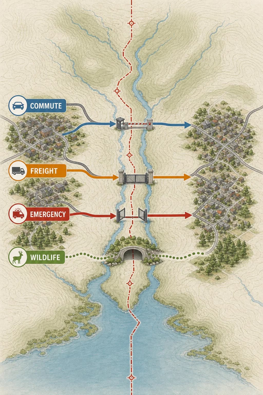
A boundary can divide labor markets, watersheds, transit routes, languages, families, and emergency services that continue to interact across it. Commuters may build routines around opening hours and document checks; firms redesign supply chains around customs time; neighboring governments coordinate bridges, water, fire response, and disease control.
Effects are uneven: a frequent traveler, a migratory animal, and an online service experience different parts of the border system. Reading a border means mapping institutions and flows as well as the legal geometry.
One boundary crosses a watershed and paired towns; commuting, freight, emergency response, and wildlife routes encounter different gates, delays, or cooperative corridors.
Key takeaways
A mapped line depends on surveys and maintained reference points
Legal crossings concentrate at infrastructure and record systems
Border effects vary by activity, place, and institution
Check your understanding
Why might a boundary commission resurvey an agreed line?
Markers, measurements, coordinates, or natural features can change or require clarification.
Why is a border better modeled as a network than a uniform wall?
Crossing and control concentrate at connected ports, routes, records, and institutions.
Name one cross-border flow besides travelers.
Examples include freight, water, wildlife, emergency services, or data.
Sources
These references were used to check the important factual claims in this edition.